
Tropical Wave 25 to Bring Up to 50 mm of Rain and Wind Gusts to Cancún on Thursday
State Civil Protection forecasts showers with lightning and very hot conditions across Benito Juárez, Isla Mujeres and northern Quintana Roo.
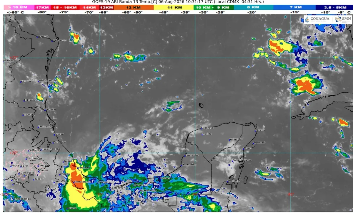
The approach of tropical wave number 25 across the southern Yucatán Peninsula, combined with moisture streaming in from the Caribbean Sea, will produce partly cloudy skies with showers and electrical activity in northern Quintana Roo on Thursday, August 6, according to the daily bulletin issued by the State Civil Protection Coordination (COEPROC).
The report estimates rainfall of between 25 and 50 millimeters in areas with the most convective activity, with maximum temperatures of 32 to 40 degrees Celsius and minimums of 22 to 29 degrees over the next 24 hours. Winds are expected from the east and northeast at 15 kilometers per hour, with gusts of 30 to 50 kilometers per hour mainly along the coast.
At sea, swells of two to four feet are forecast in the Yucatán Channel and along the state's coasts, with water temperatures between 28 and 29 degrees Celsius. The advisory covers Benito Juárez, Isla Mujeres, Puerto Morelos, Playa del Carmen and Tulum, as well as Othón P. Blanco, Bacalar and inland municipalities such as Felipe Carrillo Puerto and José María Morelos.
Civil Protection urges residents to stay hydrated, avoid intense physical activity under the sun and drive with caution due to possible morning and nighttime fog on highway stretches. Nautical operators and fishermen are asked to observe navigation restrictions because of the winds and swell.
What to do if you live or travel through low-lying areas of Cancún. With rainfall that may exceed 25 millimeters, blocks with saturated stormwater drainage often flood. It helps to clear the nearest drains, remove debris that can clog grates and avoid driving through flooded streets in a private vehicle. To report fallen trees, loose cables or severe flooding, dial 911; anonymous reports go to 089.
Tropical wave 25 is a common summer weather feature; its passage across the peninsula usually brings short but intense bursts of rain followed by heat and humidity. The Atlantic hurricane season runs from June 1 to November 30, so state authorities insist that families keep an emergency plan and a go-bag with documents, water, medicine and a flashlight ready.
Related
The National Civil Protection agency calls the exercise, with alerts by cellphone, radio, TV and loudspeakers; Cancún buildings can sign up.
Some 26,600 tons have been removed in Benito Juárez so far this year, nearly double the same period in 2025; landings concentrate in the hotel zone.
State Civil Protection forecasts downpours with lightning and coastal wind gusts; the Caribbean has no active cyclones and Tropical Storm Cristóbal is moving away in the Atlantic.
The system is still far away, near Cabo Verde, and poses no immediate threat to Quintana Roo; a good moment to review your family plan.