
Tropical Wave 20 Lingers: Rain, Heat Index up to 45 °C and 40 km/h Gusts This Wednesday in Quintana Roo
State Civil Protection forecasts 5 to 25 mm of rain; Isla Mujeres will see the highest heat index in the state. Tips against extreme heat and highway fog.
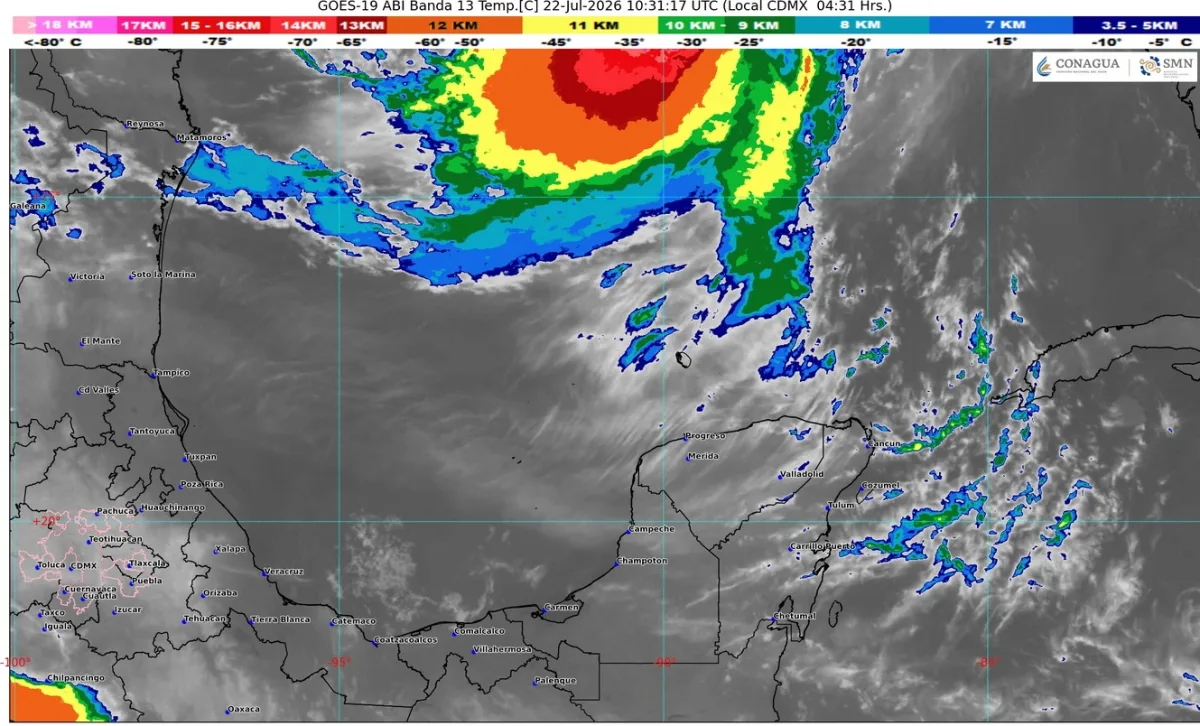
Tropical wave number 20, moving across the southern Yucatan Peninsula and combined with moisture flowing in from the Caribbean Sea, will keep showers falling over Quintana Roo this Wednesday, July 22, with expected rainfall of 5 to 25 millimeters, according to the weather bulletin issued by the State Civil Protection Coordination (COEPROC), valid from 6:00 a.m. today through 6:00 a.m. Thursday.
The number that matters most today is the heat: in Isla Mujeres the heat index could reach 45 °C, with highs of 38 to 40 °C — the hottest reading in the state. In Benito Juárez (Cancun), temperatures will range between 35 and 37 °C with a 40 °C heat index; Playa del Carmen expects 34 to 36 °C feeling like 39 °C, and Chetumal 33 to 35 °C feeling like 38 °C. Lows will hover between 25 and 28 °C statewide.
Winds will blow from the east and southeast at 15 to 25 km/h, with gusts up to 40 km/h along the coast, and waves of about 3 feet in the Yucatan Channel and off the Quintana Roo shoreline, so authorities urge caution for maritime navigation and water activities.
What Civil Protection recommends
COEPROC advises avoiding strenuous activity under the sun, drinking water constantly, and wearing light-colored clothing, sunscreen and head protection such as caps or hats. On highways, it warns of fog banks overnight and in the early morning that cut visibility, especially in the central and southern parts of the state.
Staying safe with a heat index of 40 to 45 °C
At these levels, heat stroke is a real risk, especially for children, older adults and outdoor workers. Schedule heavy activities before 10:00 a.m. or after 5:00 p.m., never leave people or pets inside parked vehicles — not even for a few minutes — and watch for warning signs: hot, dry skin, dizziness, confusion or a racing pulse. If they appear, move the person to the shade, cool them down with water and call 911.
Tropical wave rains typically concentrate in the afternoon and evening. Official updates are available through COEPROC's daily bulletins and National Meteorological Service advisories.
Related
The National Civil Protection agency calls the exercise, with alerts by cellphone, radio, TV and loudspeakers; Cancún buildings can sign up.
Some 26,600 tons have been removed in Benito Juárez so far this year, nearly double the same period in 2025; landings concentrate in the hotel zone.
State Civil Protection forecasts downpours with lightning and coastal wind gusts; the Caribbean has no active cyclones and Tropical Storm Cristóbal is moving away in the Atlantic.
The system is still far away, near Cabo Verde, and poses no immediate threat to Quintana Roo; a good moment to review your family plan.