
COEPROC Bulletin Flagged 40°C Heat Index and Isolated Rain for Cancún
The July 12-13 meteorological bulletin from Quintana Roo's Civil Protection Coordination anticipated scattered showers, easterly winds and elevated swell along the northern coast.
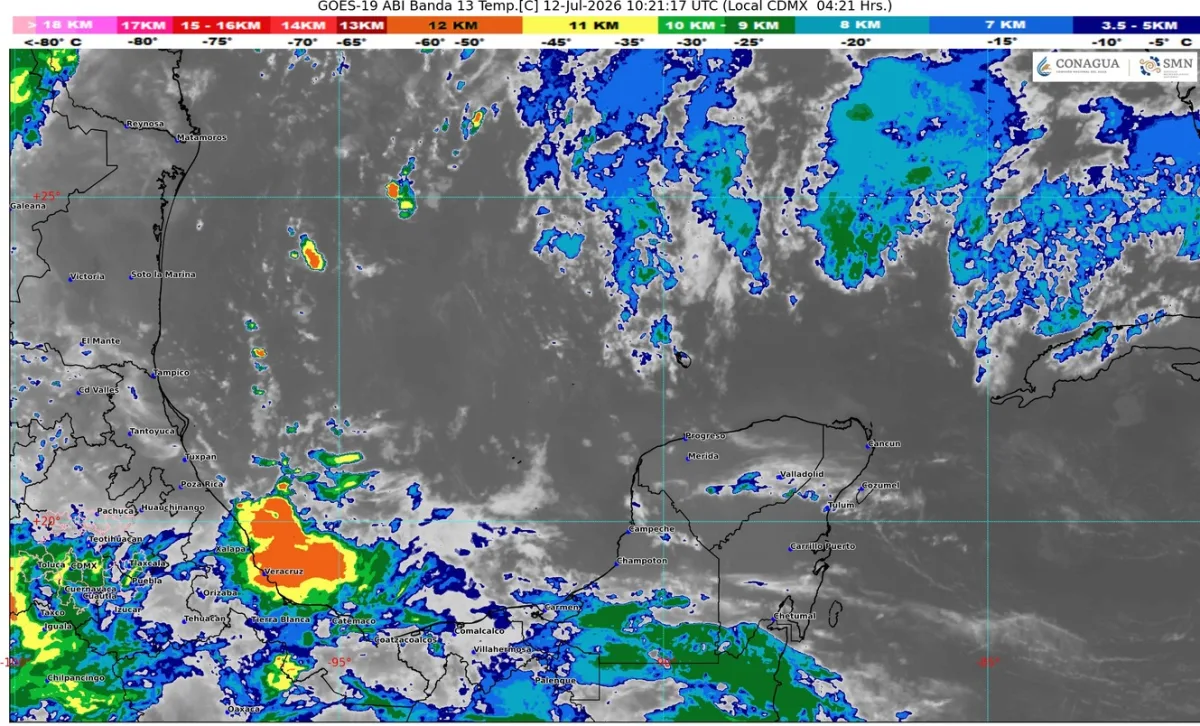
An upper-level trough parked over the southeastern Gulf of Mexico and the Yucatan Peninsula, combined with moisture flowing in from the Caribbean Sea, brought scattered showers to Cancún and northern Quintana Roo, with rainfall totals of 5 to 25 millimeters, according to a weather bulletin from the State Coordination of Civil Protection (COEPROC). The bulletin was in effect from 6:00 a.m. on July 12 to 6:00 a.m. on July 13, 2026.
For the municipality of Benito Juárez, home to Cancún, the bulletin described partly cloudy skies with increasing cloud cover through the day, a high of 35 to 37 degrees Celsius and an overnight low of 25 to 27 degrees. The heat index, COEPROC noted, could climb as high as 40 degrees because of the combination of heat and humidity. Winds blew out of the east at 15 to 25 km/h, with stronger gusts at times.
Along the coast, wave heights ranged from 1.0 to 2.0 meters, while the Yucatan Channel saw swells of 4 to 7 feet and sea temperatures of 28 to 29 degrees.
Given those conditions, COEPROC urged residents to avoid strenuous outdoor activity in direct sun and to stay hydrated, to wear light clothing, a hat and sunscreen, and to drive with extra caution because of possible patches of fog. The agency also asked anyone planning activities on the water to check first with the local Port Captaincies, given the elevated winds and swell.
The episode came just days after tropical wave number 18 moved through the region, bringing rain and lightning; ambient humidity remained high afterward, prompting officials to urge continued caution.
For residents of Cancún neighborhoods prone to flooding, the practical takeaway is to avoid discarding trash that can clog storm drains and to never attempt to cross flooded streets, a common cause of accidents during the rainy season. In an emergency, the number to call is 911, and updated bulletins are published daily on COEPROC's website and social media accounts.
Related
The National Hurricane Center issued its final advisory and is not monitoring any area of possible development over the next 7 days.
Public Services handled 20 reports; residents can request cleaning of their street via ChatCun on WhatsApp.
Mexico's weather service expects 50–75 mm of rain and 1–2 meter waves along the Quintana Roo coast as the storm moves away to the northeast.
COEPROC coordinated the army, Conagua, CFE and firefighters over three days; storm drains are being cleared in Chetumal.